
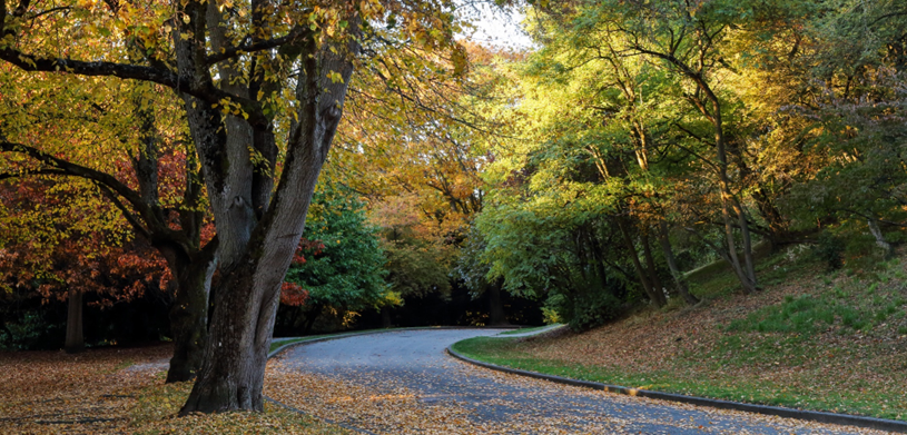
Seattle, WA – The City of Seattle today released the final 2021 Tree Canopy Assessment showing the city has lost 255 acres of tree canopy since 2016 (an absolute decrease of .5% and 1.7% relative decline), an amount roughly equal to the size of Green Lake. Seattle’s 2021 tree canopy cover is 28.1%, down from 28.6% in 2016. Seattle’s goal is to achieve 30 percent citywide canopy cover by 2037, distributed equitably, as well as to improve tree health and resilience to climate change.
“Critical for ensuring Seattle’s standing as a truly emerald and evergreen city, trees provide essential benefits to our communities from heat mitigation to air quality improvement and overall wellbeing. This decline in canopy cover means we need to do more to plant, preserve, and protect trees to meet our goals for Seattle’s canopy, climate, and communities,” said Seattle Mayor Bruce Harrell. “The information in this report is informing our upcoming efforts to drive improvements — including new strategies to plant more trees and maintain our existing canopy, all while prioritizing equity in neighborhoods who face the worst impacts of climate change.”
Additional findings from the report include:
- Canopy loss is not happening equitably. Neighborhoods impacted by racial and economic injustice started with less canopy and lost more than the citywide average. Compared to neighborhoods with greater advantages,[1] these neighborhoods had 31% less canopy in 2021, an increase in disparity from 2016 (when they had 27% less). While there were some canopy gains in environmental justice priority areas attributed to forest restoration programs, the losses outpaced the gains.
- Tree canopy cover is critical for lowering temperatures and reducing heat island effects in our warming climate. Trees are a key component of our climate preparedness and resilience strategies as they protect us from extreme heat and improve air quality. The report finds that, on a hot day, neighborhoods[2] with 25% canopy cover were 1 degree cooler than neighborhoods with no canopy. Industrial areas and major transportation corridors have lower canopy and warmer temperatures. These conditions were also found in some neighborhoods, such as in the Chinatown-International District and in the south end of Rainier Valley.
- All Management Units (areas based on land use types) lost canopy, with Parks Natural Areas and Neighborhood Residential areas seeing the greatest net losses. Combined, losses in these two Management Units comprise 78% of the total canopy loss during the assessment period.
- Parks Natural Areas make up only 5% of the city’s land but due to their concentrated canopy, they contribute 14% of the city’s canopy. Forty-three percent of the canopy loss during the assessment period was in these areas, an amount equal to 111 acres. These areas require active management to ensure long-term forest health and resilience, and losses here may be due to aging deciduous trees coming down naturally or being selectively removed to allow for growth of evergreen trees.
- Neighborhood Residential areas make up 39% of the city’s land, and with roughly 1/3 of that area covered by canopy, they contribute nearly half of the City’s canopy (47%). Roughly a third (34%) of the canopy loss during the assessment period was in these areas, an amount equal to 87 acres. Most trees on residential land were likely lost due to reasons other than development, although the small percent of residential land that underwent development during the study period experienced higher canopy losses.
“The data show we are further away now than we were five years ago from our goal of 30% canopy coverage,” said Jessyn Farrell, Director of Seattle’s Office of Sustainability & Environment. “To reverse this backward slide and achieve our vision of an equitably distributed urban forest in Seattle, our strategies must better align development and tree preservation and include innovative and equity-driven actions in planning, maintenance, planting, and engagement. In short, a healthy, thriving Seattle needs more housing and more trees and we can absolutely do both.”
Recommendations provided in the report include:
- Expand and deepen partnerships to plant new trees on both private and public property—focusing specifically on environmental justice priority areas—and plan for and fund their care.
- Prioritize protecting and caring for existing trees as one of the most effective ways to ensure future tree canopy.
- Incorporate current and expected future climate change impacts into our planting and maintenance practices.
- Implement a strong regulatory framework that aligns our goals for tree preservation with housing production and development needs for our growing City.
“The reasons for tree canopy loss are complex and not due to one single cause, and our solutions must also be multi-faceted,” said Patti Bakker, Urban Forestry Advisor with Seattle’s Office of Sustainability & Environment. “Climate change, aging trees, making way for other uses such as infrastructure, development projects and other needs in residential yards, increasing budget and maintenance costs and more, all contribute to changes in our tree canopy. We will continue to work to improve the stability and coverage of our tree canopy so the benefits of our trees can be felt by all.”
Seattle’s tree canopy includes trees in public spaces like parks, forested natural areas and rights-of-way; private lands like neighborhoods and spaces like universities and the Arboretum. The assessment was conducted by the University of Vermont Spatial Analysis Lab and combined light detection and ranging (LiDAR) data and aerial imagery to measure the layer of leaves, branches, and stems to determine the change in our urban forest over time.
The City will continue to conduct detailed analyses with the data sets resulting from this assessment to develop a Tree Canopy Equity & Resilience Plan, which will serve as the citywide plan for how we will equitably reach our canopy cover goals, and to continue to update our urban forestry management work. The City is working to make the data sets available to the public.
[1] Neighborhoods are based on categories in the Office of Planning and Community Development’s 2019 Race and Social Equity Index.
[2] Neighborhoods, in this case, refer to an analysis unit roughly the size of several city blocks.